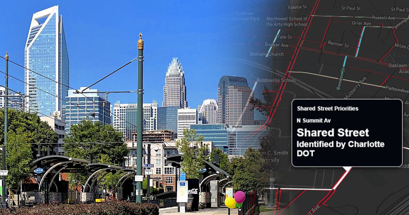
On May 9, 2020, the City of Charlotte will launch Phase 1 of their Shared Streets program. According to the Charlotte Department of Transportation (CDOT) announcement, Shared Streets will designate select streets for wheelchair rolling, walking, biking, skateboarding, and roller blading by closing them to through traffic. The goal of Shared Streets is to increase the amount of space for socially distant activity, exercise, and movement in the city’s neighborhoods.
In this blog post, Wells + Associates Charlotte TDM team analyzes which streets in Charlotte might be eligible for an expanded “Phase 2” of the Shared Streets program. This is part of a series of articles we are publishing relating to how transportation is changing as a result of the coronavirus pandemic, such as our analysis of bikeshare usage.
Charlotte’s Shared Streets: Phase 1 Explained
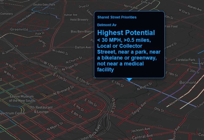
To be considered for inclusion in the Shared Streets program, streets cannot be a thoroughfare, must be at least 0.5 miles in length, have a speed limit of 30 mph hours or less, and ideally connect with a bike lane, greenway, or park. Streets connecting with or providing access to medical facilities and essential businesses will be deprioritized.
Phase 1 of Shared Streets will include McClintock Road from the Plaza to Morningside Drive, Romany Road from Myrtle Avenue to Kenilworth Avenue, and Jameston Drive/Irby Drive/Westfield Road from Freedom Park to Brandywine Road. An additional five potential locations are planned and being evaluated to further expand the Shared Street network. City officials are encouraging residents to suggest additional locations for future phases.
Beyond Phase 1: Where Could Charlotte’s Shared Streets Expand?
Beyond the initial launch of the program, additional street segments will be added in an effort to expand the Shared Streets network.
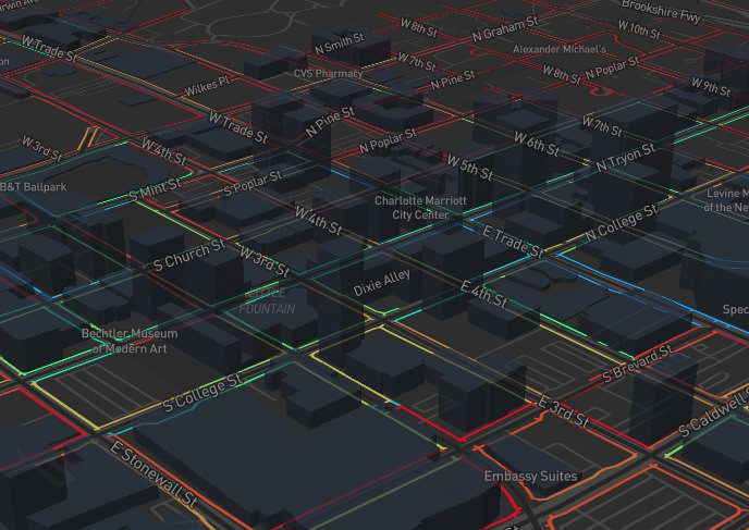
Using the CDOT’s eligibility criteria and open data from the City of Charlotte and Mecklenburg County, we analyzed the rest of the city’s streets to highlight potential candidates for inclusion in the program. Our “phase 2” Charlotte Shared Streets interactive map prioritizes streets by how many of the eligibility requirements a street meets and can hopefully help Charlotte residents understand where the program could expand.
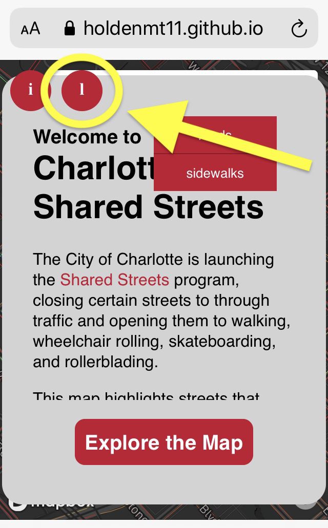
When you first visit the map, click on the right-hand red circle labeled “l” for legend to view the color categories.
White Streets: Phase 1 Shared Streets
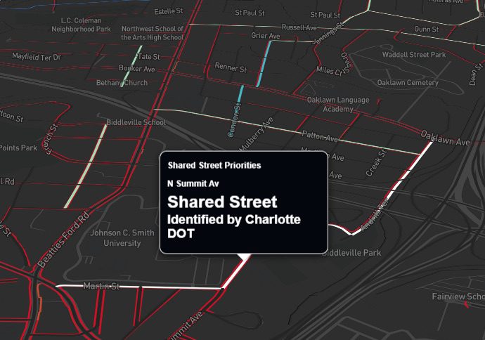
On the map, streets already identified by CDOT as potential Shared Streets are highlighted in white.
Bright Blue Streets: Highest Potential for Phase 2
The highest priority streets meet all of the CDOT criteria and are shown in bright blue. These streets have speed limits less than 30 miles per hour, are at least half a mile in length, are not designated as a thoroughfare, help connect to a park, bike lane or greenway, and avoid medical facilities. Streets in this category help maximize recreational potential, while also providing the least amount of disruption to automobile traffic.
High, Medium, Lower, and Lowest Potential for Phase 2 Shared Streets
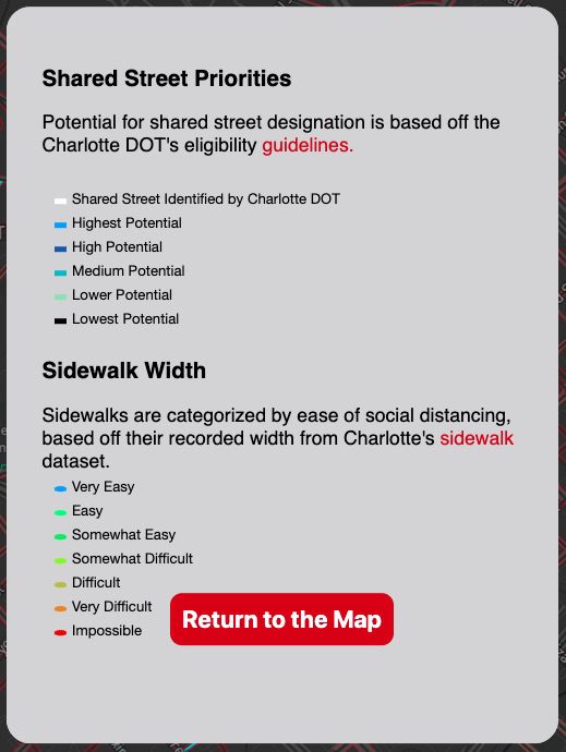
The categories scale down, with streets meeting less of the criteria in each category. On the map, dark grey streets are not likely to be considered, either due to high speed limits, proximity to medical facilities, or their classification as thoroughfares. Additionally, streets maintained by the North Carolina Department of Transportation are not eligible for Shared Street designations.
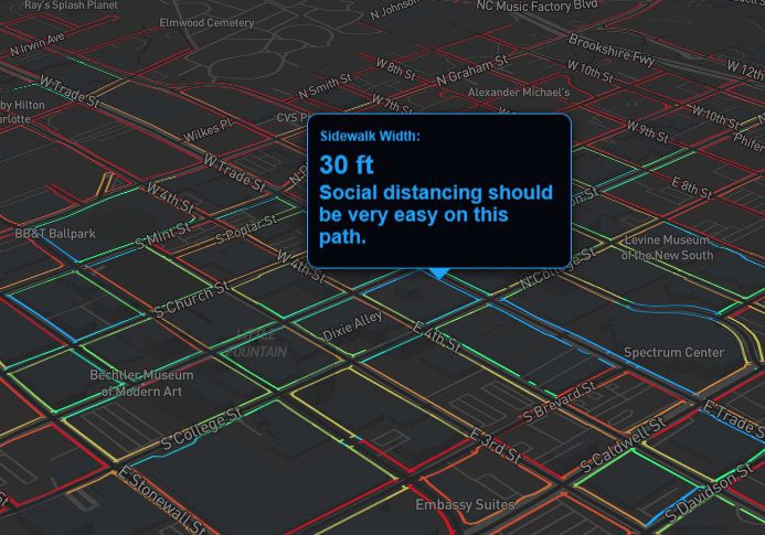
In addition to ranking Charlotte’s streets for Shared Street compatibility, the map adds a sidewalk layer that categorizes them by width. Sidewalks are essential pieces of transportation infrastructure, allowing people to safely move about their neighborhoods and providing connections to amenities and transit facilities. Unfortunately, many sidewalks are less than six feet in width, making it impossible for people passing to maintain the recommended amount of distance between each other.
Sidewalk categories (each identified by a unique color):
- Very Easy
- Easy
- Somewhat Easy
- Somewhat Difficult
- Difficult
- Very Difficult
- Impossible
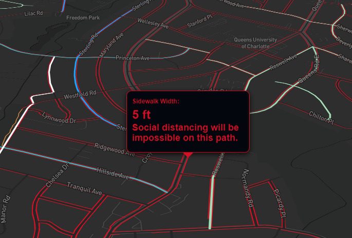
The large amount of red on the map (sidewalks less than six feet in width) further stresses the need for more space for safe, outdoor activity. In fact, Uptown is the only neighborhood with a significant density of sidewalks wide enough to easily social distance.
In our opinion, this fact strengthens Charlotte’s rationale for the Shared Streets program.
 If you know of any streets that should be included in the program, the Department of Transportation is actively seeking input and they can be contacted at: CharlotteDOT@charlottenc.gov
This map was inspired by sidewalkwidths.nyc and was built using the Mapbox web mapping platform. More information on the map and data sources can be found here.