Talk about multi-modal!
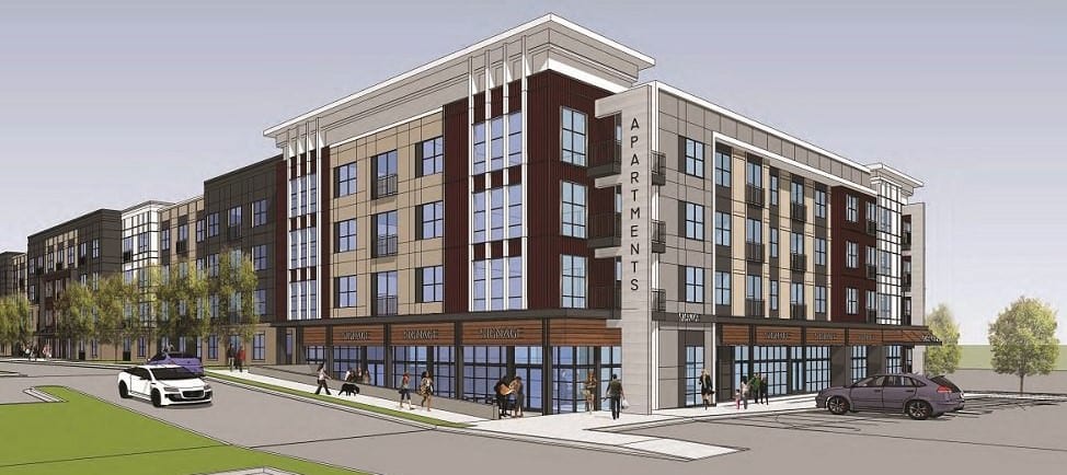
 A former (but little known) 1940s airfield-turned-shopping-center was recently approved by the Fairfax County Board of Supervisors to be redeveloped as a mixed-use project. The western portion of the shopping center known to locals as Loehmann’s Plaza (rebranded as Graham Park Plaza) will be reconstructed by Federal Realty Investment Trust with upgraded retail shops, restaurants, and a 210-unit apartment building.
The site is in a stable location in Fairfax County, and follows the trend of other older shopping centers by creating a 24/7 population that brings vibrancy to the community. The residential building will be pet friendly with modern amenities, and an open space area created in an urban park framework, with benches, covered seating areas, and landscaping will be provided to invite patrons from the surrounding neighborhoods.
We worked with the development team to design the traffic circulation plan and site access systems for both vehicles, pedestrians, and cyclists, and prepared the traffic impact study. The project will include TDM (transportation demand management) elements to minimize impacts within the area.
Really? A Former Airfield – in Falls Church, Virginia?
Now, back to that initial comment about an airfield – in Falls Church, no less!
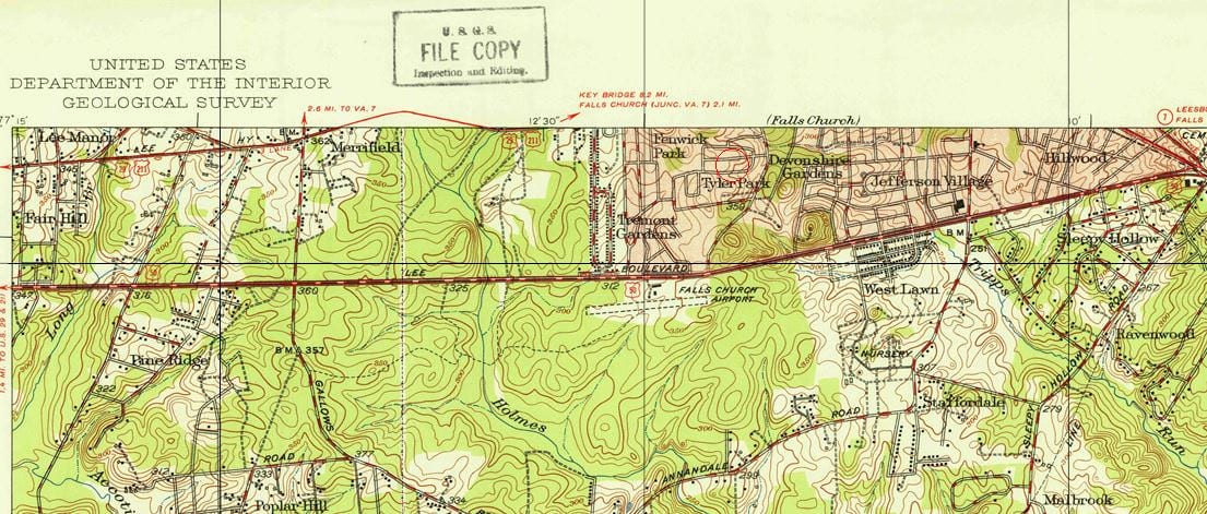
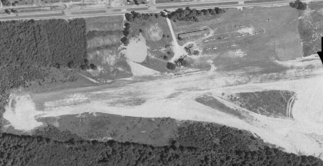
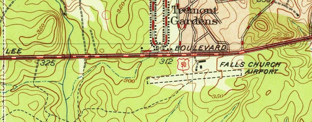
From 1945 to 1961, Falls Church Airpark was located on the land commonly known as Loehmann’s Plaza (click on the 1951 topographical map made by the USGS in 1951 to see the way it used to look). For most of us, this would be the last place that we would think airplanes would land. But if you take a closer look at the length of the shopping area that will now be transformed yet again, you can see that its length could definitely accommodate an airfield.
The state-licensed airpark opened in 1946 with a single grass runway that was 2,650-feet long. In 1949, a report described the runway with language that would make us traffic engineers cringe: “…poorly graded and hazardous after rains.” Two years later, a crosswind airstrip was added. That’s something we like: more, and safer, transportation options!
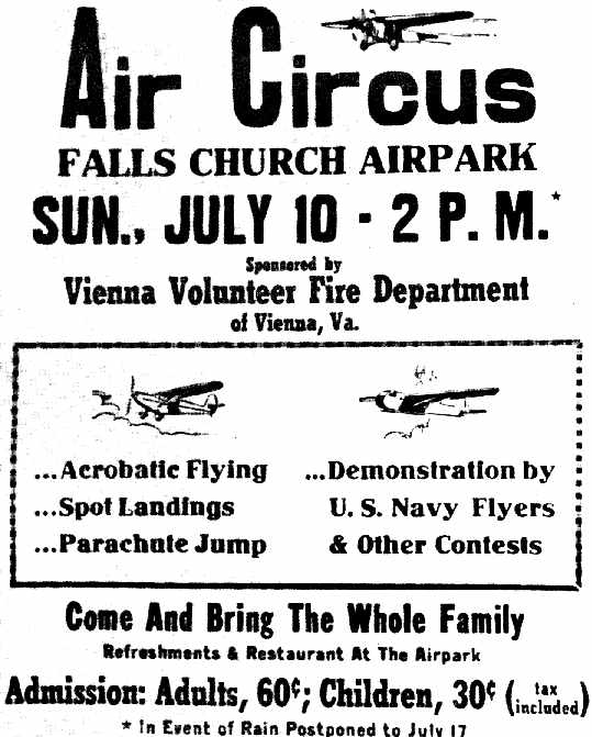
What was Falls Church Airpark used for? Everything from general aviation, civil defense, medical transportation, and air shows to pilot training. The heyday of the airfield appeared to be the 1950s, when a local flying club would fly family members to places like Rehoboth beach for some vacation time. With the Chesapeake Bay Bridge’s opening in 1952, it’s no wonder that Washington, DC-area residents started flocking to the Delaware and Maryland beaches, but little did we know that air transportation was another option!
Despite this, it appears that a number of fatalities and the local neighbors’ protests at the “nuisance” of the airplanes led to the airfield’s closing and conversion to a shopping center.
That shopping center, now known as Graham Park Plaza, has served the growing Northern Virginia population for over 50 years. With Federal Realty’s redevelopment of the western half of this property, local residents can look forward to yet another upgrade to the site that once used to send planes into the sky. While the site no longer handles air traffic, Graham Park Plaza now helps serve vehicle, bus, pedestrian and bike traffic to help create a vibrant neighborhood and shopping center for residents and patrons.
For a really cool writeup about the Falls Church Airpark, visit the Abandoned and Little-Known Airfields website.
Top image of Graham Park Plaza mixed use by Dwell Design Studio.