The DC Metrorail system seems to offer more headaches than solutions for commuters these days. The SafeTrack rebuild is disruptive and other problems seem never-ending. The “cultural” issues also can annoy: think of those two irksome announcements from train conductors that captive-audience riders loathe when crowded on a rush-hour train:
“There is a train directly behind this one.” (Rider: “Directly? Not when it’s eight minutes later!”)
“The train will be leaving momentarily.” (Rider: “Five minutes is NOT ‘momentarily’!”)
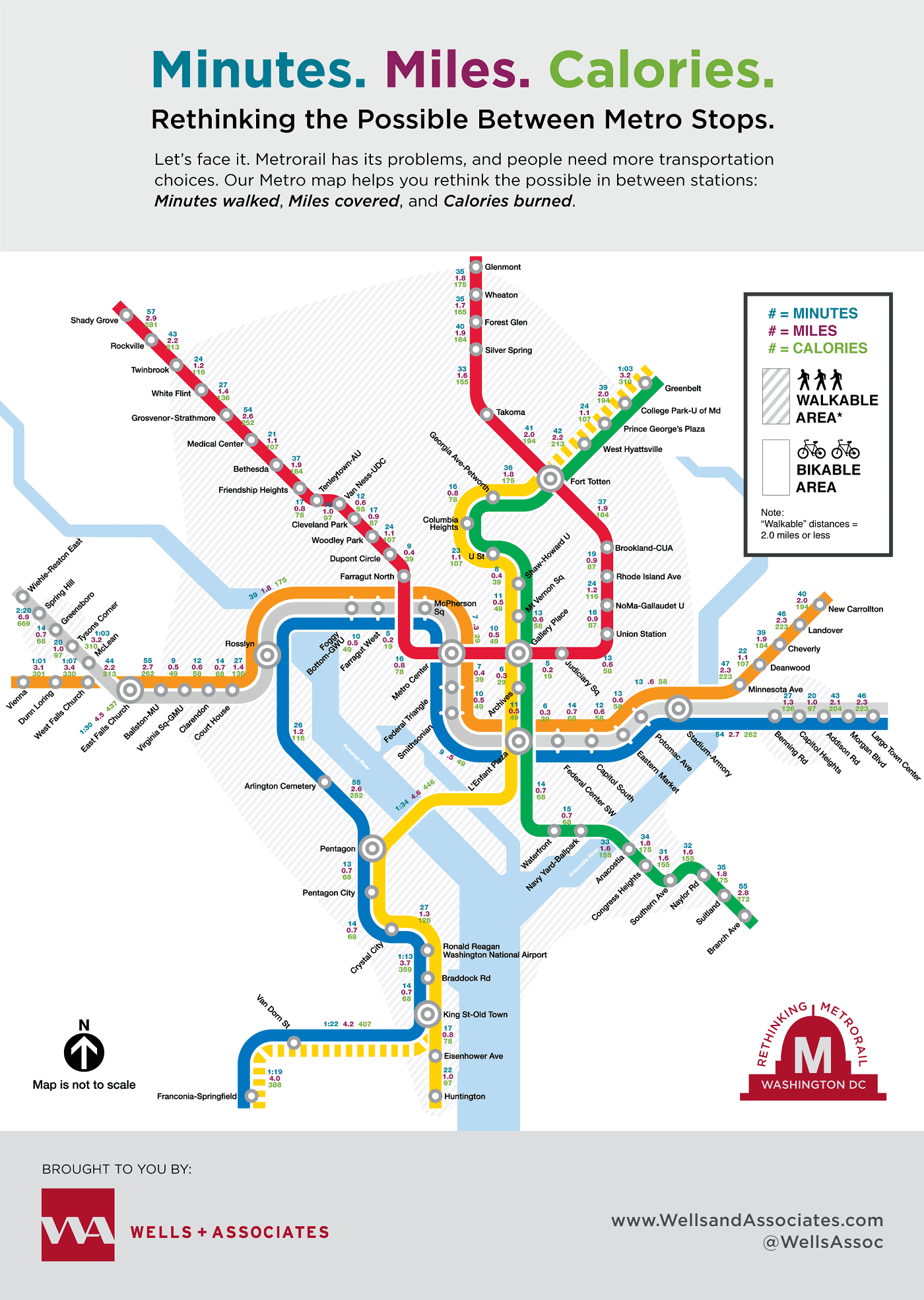
Instead of more transit headaches, people need more transportation choices. Options? Escape the train early. Park and then walk/ride for part of your commute. You get the idea.
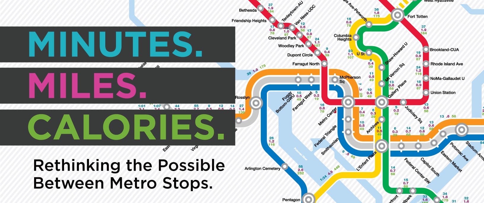
Rethinking Metrorail: Minutes Walked, Miles Covered, Calories Burned
Our Rethinking Metrorail Map helps you rethink the possible in between stations: Minutes walked, Miles covered, and Calories burned. It also represents our thinking and our mission at Wells + Associates: to improve mobility and bring more transportation choices to everyone.
Feel free to share it!
Note: Miles and Minutes data was sourced from Google Maps. The data for calories burned is an estimate based on population demographics and generally accepted calorie-burning data for pedestrians found on the interwebs.