How can federal government agencies evaluate the impact of transportation, commuting, and office amenities when considering new or relocated locations for their offices?
One method is to perform a comprehensive geospatial analysis, considering the locations of proposed or existing offices, employee commute patterns, and both existing and proposed transportation infrastructure.
Post-Pandemic Strategies for Office Commuting
The United States has emerged from the COVID-19 pandemic with facing the ongoing major challenge of how to successfully integrate in-office working with the demands of a hybrid workforce. Federal government agencies are not immune to these trends. As office space needs to evolve alongside changes in commuting patterns, transportation-based strategies become key components to achieving successful outcomes.
Employers are discovering that transportation-based strategies, tailored to individual office property locations, can optimize how employees connect with their office environments.
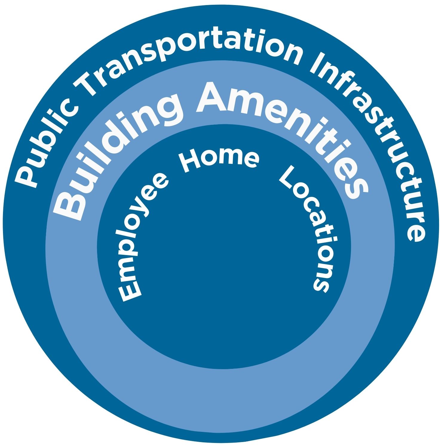 Our work in geospatial mobility assessments has allowed us to evaluate the transportation connectivity between three key elements:
- Public Transportation Infrastructure: Includes existing and future transportation facilities around the building that facilitate public commuting.
- Building Amenities: Focuses on features inside the building that enhance convenience and accessibility for employees.
- Employee Home Locations: Provides insights into commuting patterns and preferences, based on where employees live.
With the challenges of commuting and managing workforce patterns, considering these elements is important when deciding on locations for federal office space in the National Capital Region (NCR).
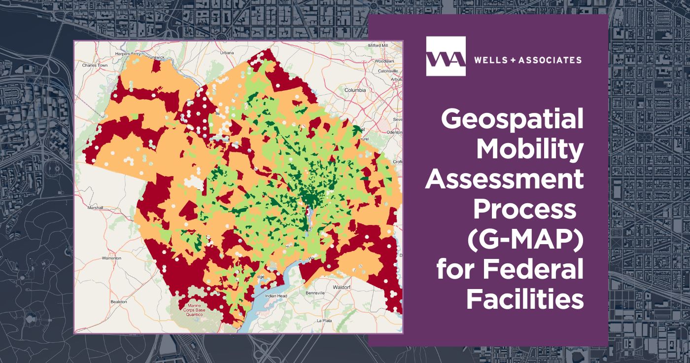
G-MAP: Geospatial Transportation Analyses for Government Agencies in the National Capital Region
Recognized by the American Planning Association’s Federal Planning Division as an Outstanding Technical Plan or Study, G-MAP is a geospatial tool that helps federal agencies in the NCR promote more sustainable transportation options for Federal office properties by providing information across all three of these components:
- transportation amenities,
- available transportation infrastructure, and
- how the office property connects employees with that infrastructure.
Additionally, it supports agencies in meeting the Metropolitan Washington Council of Governments’ (MWCOG) “Visualize 2045’s” goal, which aims to bring jobs and housing closer together. It does this by prioritizing the National Capital Planning Commission’s (NCPC) Comprehensive Plan goals of connecting transportation and land use as well as promoting efficient and sustainable travel to federal destinations through a robust analysis of Federal property locations and surrounding transportation infrastructure.